
Above, just one of the effects of Storm Ida. Give me no more bs. about global warming.
The storm affected both rides I did this weekend. Laura OLPH posted a ride with no reliable indication of route or distance, because from what we could see of the damage locally, we presumed that the Sourlands would also be affected, and we might not be able to get through places we usually go. We didn't even consider Lambertville, on the river; we decided to try for Sergeantsville.
Before the ride, Tom invoked some magic. The video is too big to upload, but the Holy Kickstand was involved.


Off we went. After the experience in the first picture, we tried to get across Covered Bridge Road.


We were turned away by a resident whose property was damaged by the flood, and who was obviously at the end of her rope (you can see one of the turnbacks on the ride page).
We stopped at that bagel place that's near, but not at, the Sergeantsville general store. I mostly got bike pics.


Above, Ming and Tom show similar taste in bike socks.
We decided to visit the covered bridge by another direction.


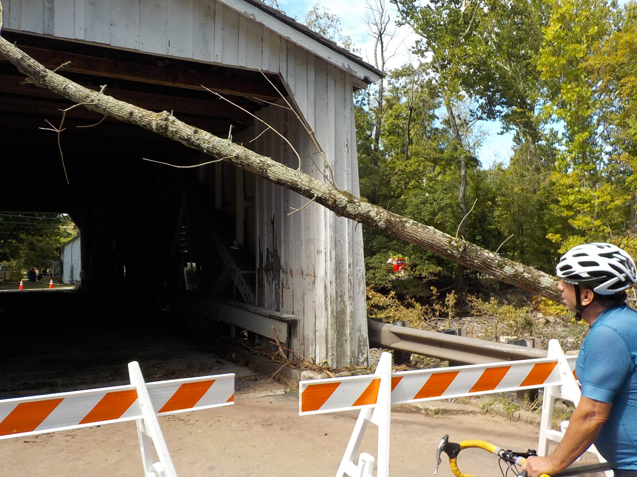


The Sergeantsville bridge has the wooden covered structure placed on a concrete and metal bridge, so the damage can be rebuilt (and probably will be). But it's such a landmark on our rides! I found the condition sobering.


In case you didn't get it above, another link to the ride page.
I had waited to post a ride for today, and then, when I did, I didn't post a route because I wanted to wait to see what roads would be open. Reports were inconsistent and unreliable, so I made a point, on the way home from yesterday's ride, to drive River Road below Rocky Hill and Canal Road (cones were up, but I figured I'd say I came down Old Georgetown if I were stopped, which I wasn't). River Road showed no damage, and Canal Road appeared generally clear, albeit with mud and some abandoned vehicles.
So I decided on a route down to Kingston, then up through Montgomery to Amwell Road and then to Schoolhouse, then down Blackwells Mills to Canal (not going over the causeway) and back to the Claremont School. The damage on the lower part of Canal Road was visible, but should not have stopped traffic, although we did go through the "Road Closed" signs. The route back up into Montgomery was uneventful; we stopped at the arboretum to enjoy the porta potty.


I did a real-estate tour through Montgomery up to Millstone, and then led the group up Mettlers Lane by Colonial Park, where there was more damage (there is a waterway there, but I'd forgotten about it). We went across Schoolhouse Road and came back down, and rolled down Blackwells Mills to take the left on Canal Road...
...much of which was still mud-covered, with trees jutting out into the roadway. In many places, the road was reduced to a single lane. There was an unusually large amount of traffic in both directions; we later saw that the traffic on Middlebush was being detoured to Canal Road.
Wait... How come the lower part of Canal Road was closed, but passable, when this part was open, but had such interference? And why wasn't the Middlebush traffic directed to Route 27? I'd like a word with the Franklin town council.
No comments:
Post a Comment