Tom H, who wrote the book about road riding in NJ, decided to lead a hilly 50-or-so-miler that was not an official Princeton Freewheeler ride (but I'm lucky enough to know the right people to get to know about, and get invited on these). Although The Excellent Parents-In-Law are still having medical problems (in fact, I'm at their house as I'm writing this), I was able to get away for the day to go along on this ride. (In fact, The Excellent Wife (TEW) was going out with a couple of friends on their own ride... but more about that later, if I remember.)
We met at Bulls Island near Stockton,
...and did this route. We started on a flat section of Lower Creek, then went up to the covered bridge near the (oft-mispronounced) Sergeantsville, then climbed Upper Creek. The climbs weren't bad for me, but I had another issue: I've written before about how much I like my Serfas Gladiator Glasses with the prescription inserts. They have four sets of replaceable lenses, three of which have tints. I broke the moderately-tinted once wen I had my crash, so I put some darker ones in. Well, with the mottled shadows on the road in the early sun, I couldn't tell where the holes and cracks in the road surface were! And after the crash, I'm hypervigilant about the road surface... so when I got back, I put the light tints in; they'll probably stay in for a while.
Upper Creek, though, leads to a neat downhill to the river, and we crossed and stopped at Black Eddy.
(Terrible picture of Marco, but good picture of the bridge, I think)
(That's really a bike pic; Laura OLPH's back just got in the way)
Laura had been emailing the coffee roaster, there, and got a tour of the roastery in the barn, while the rest of us ate junk food and made stupid jokes... until I realized that, if we were stopping at Black Eddy, we were almost certainly going to climb that wicked hill that goes up from there. We did. I got behind one of the riders who had a problem getting started; I rolled across the oncoming traffic lane (luckily, nothing was coming), and couldn't get started uphill again. I had to find a reasonably flat place to get some speed up to go up, and the other poor guy had to go all he way to the bottom again.
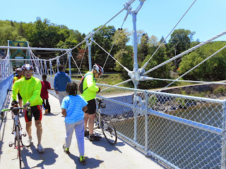
But no harm, no foul, and on we went. Tom led us through the park where Laura and I had gotten cut off on an earlier ride. It turns out that a sign saying "No Exit" is merely a suggestion if you're on two wheels, and back we came to the bridge at Lumberton. Tom needed a picture... and I decided I needed a picture of Tom getting a picture (to add to my collection of pictures of Laura getting a picture):
This was also my first ride using the Garmin Touring. I'll post more specific info as I have it, but so far, I like it.
You can see Tom's own blog post on this ride, too.
Meanwhile, The Excellent Wife (TEW) went out with two of her work
friends on a 30-mile ride up and down the D&R Canal towpath between
Frenchtown and Lambertville. They apparently enjoyed the ride, but went
at a stately pace with lots of stops; when I got home in midafternoon,
she was still not home. I didn't get a message from her until later
afternoon; they had been having fun and lost track of time. Losing track
of time on a bike? I'm not sure I know anything about that.


No comments:
Post a Comment